
Developing Local Government Policy for Land Use Planning
Local government policy language linked to mapping layers on Biodiversity Atlas
The Action for Adaptation project team undertook conversations with local government and First Nations Planners in 2021 and 2022. The planners stated that while the importance of environmental values is generally recognized, concepts like biodiversity protection and nature-based solutions are not always well understood, and often apply differently to different staff roles. Planners asked for policy text that was written in language that different types of planners can use—from long-range policy planners to those who are responsible for land use decisions and development proposals.
This section provides examples of effective environmental policy provisions that are currently in use by local governments in the project area, as well as recommended provisions drawn from key resources. To be relevant to different types of planners and decision makers, the information is sorted by granularity, from high-level coarse scale regional strategies through to OCPs, zoning, protection bylaws, and finally EDPAs at the finest scale.
Regional Growth Strategy
Nature based solutions to climate change and connectivity
Encourage land use, infrastructure, and human settlement patterns that reduce fossil fuel and the associated emissions, create carbon storage opportunities, and improve ecological connectivity.
Official Community Plan
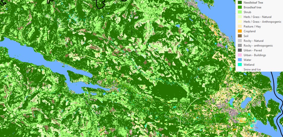
Track land cover change
Use land cover monitoring to identify different ecosystem types (e.g., forest, riparian) and aim for no net loss of native vegetation post-development.
Establish retention targets for land cover types
Use land cover change monitoring to identify retention or connectivity targets, e.g., no net loss or net gain of certain land cover types (ESA, riparian, forest, etc.).
Indicators and Targets
Track changes in land cover
- Track area impacted by development and logging. (Cowichan Valley Regional District pg 13)
- Track type and proportion of natural areas (City of Surrey pg 93)
Biodiversity Strategy
Policy language | Adapted from | Indicator / target |
Develop a long-term land cover monitoring program to reflect the state of biodiversity in the community. | District of Saanich Biodiversity Conservation Strategy, 1.6 pg 46 |
|
Develop incentives to increase density and encourage alternative development approaches (e.g. cluster housing, Conservation Subdivision Design) to retain natural areas and enhance buffer zones adjacent to green infrastructure, particularly inside the urban containment boundary. | City of Surrey’s Biodiversity Conservation Strategy A-2.6 pg 84 District of Saanich Biodiversity Conservation Strategy, 3.7, pg 52 | Density incentives are established and promoted. ## of hectares of natural area protected through alternative development approaches. |
Establish forest canopy baseline and cover targets for different land uses that will contribute towards the community goal of ##% canopy cover. | City of Surrey’s Biodiversity Conservation Strategy A-2.9 pg 85 | Canopy cover baseline and targets established. |
Develop / support a tree incentive program to increase tree cover on private land. | City of Surrey’s Biodiversity Conservation Strategy A-2.11 pg 85 | # of private land owners utilize the incentive program by [date] Tree canopy or number of trees on private land increased by X% by [date] |
Develop / update the Tree Bylaw to enhance protection and replacement criteria for all healthy single stemmed trees with a diameter greater than 100 cm measured at 1.4 m above ground. | City of Surrey’s Biodiversity Conservation Strategy A-2.12 pg 85 | Tree Bylaw created / updated with specific targets |
Develop or update ground-truthed terrestrial ecosystem mapping (TEM) that identify disturbance levels. | District of Saanich Biodiversity Conservation Strategy, 1.4 pg 46 | TEM updated/completed by [date] |
Review and update existing data capture guidelines and develop a structured procedure for evaluating and submitting data to be included as part of terrestrial ecosystem mapping. | District of Saanich Biodiversity Conservation Strategy, 1.2.2 pg 45 | TEM data guidelines updated by [date] and widely shared. |
Land Cover – Objectives
- Manage growth and protect Environmentally Sensitive Areas by directing new development into existing serviced areas by establishing urban containment boundaries.
- Maintain and enhance urban forest and canopy cover.
Environmentally Sensitive Areas – Objective
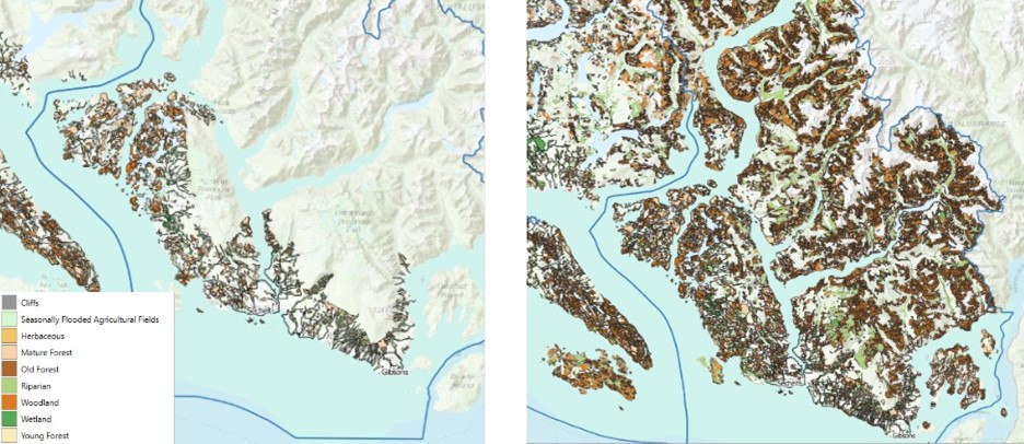
- Protect and enhance ESAs including wetlands, riparian areas, mature and old growth forests and the connections between them.
Other objectives listed in RGS / OCPs that overlap with policies:
- Establish or update ESA mapping.
- Establish policy / regulation, binding mechanisms and enforcement to guide development away from ESAs.
- Monitor the ecological health of ESAs.
- Provide conditions in permits that emphasize naturescaping principles into landscaping, using a diversity of locally native plants.
Regional Growth Strategy
Identify and protect natural areas
Work with the federal and provincial governments to identify and protect natural areas that are representative of the region’s ecosystem and form systems of interconnected areas and natural corridors capable of sustaining native plant and animal communities.
Increase awareness in the community of ecosystem services
Work with property owners, businesses, the provincial government, and First Nation communities to improve, support, and increase awareness of the essential services that forests provide in the region such as:
- ecological diversity and a healthy natural environment
- natural stormwater management, erosion reduction, water filtration
- carbon dioxide storage
- air temperature moderation in urban areas
- spiritual and cultural enrichment
Develop online mapping tools
Use a sensitive ecosystems atlas as a common method of collecting and displaying conservation and environmental information.
Update mapping of ESA
Encourage local governments to either individually or jointly regularly update environmental mapping that depicts critical information such as sensitive ecosystems, watercourses and riparian areas, parks and greenways.
Bio-inventory of ESAs
Prepare a complete bio-inventory of regionally significant ESAs, SAR, and the natural biodiversity of the region.
Official Community Plan
An ecosystem-based approach to planning and management will be used to preserve ecological health and the ongoing function of ecological processes.
Protect ESAs in a natural conditions
Preserve sensitive ecosystem areas, their living resources, and connections between them in a natural condition and maintain these areas free of development and human activity to the maximum extent possible.
Produce an Urban Tree Strategy to protect canopy cover
Protect and expand the existing urban forest / tree canopy through implementation of an Urban Forest Strategy, ensuring that planted tree species are appropriate for forecast climate conditions and that large native trees are preserved.
Regional approach to protecting ESAs and connectivity
Collaborate with landowners, other levels of government, non-governmental organizations, and neighbouring jurisdictions in developing regionally consistent approaches to conserving, and restoring environmentally sensitive areas, watershed health and species at risk, using the principles of precaution, connectivity, and restoration.
Develop Management Plans for Parks
Develop management plans for all natural area parks that focus on protecting or enhancing ecological integrity of ecosystems, ESAs, and connectivity corridors.
Restore damaged ecosystems
Work in collaboration with property owners, developers, businesses, and appropriate provincial and federal agencies to restore damaged ecosystems and utilize mapping to identify highest priority areas.
Mapping
Regularly update ecosystems data
Regularly update ecosystem data (e.g., terrestrial, aquatic, marine, invasive species, and species at risk) as new information becomes available and make it available on a public GIS portal. Continue to refine the precision of terrestrial ecosystem polygon boundaries through ground-truthing and high-resolution ortho imagery.
Collaborate for regional approach to mapping
Collaborate with landowners, other levels of government, non-governmental organizations, and neighbouring jurisdictions to develop regionally consistent approaches to inventorying and mapping ESAs and species at risk.
Map a baseline of ecological condition
Map and inventory baseline ecological conditions before deciding what to change: to inform long-term planning, establish and fund a land cover and land cover change monitoring program that targets natural areas and features.
Indicators and Targets
Maintain urban canopy cover
- Target goal of 40% canopy coverage for the entire city (Surrey pg 149); or
- Achieve 40% tree canopy cover within the Urban Containment Boundary (Metro Vancouver pg 35); or
- Every neighbourhood has at least a 30% canopy coverage (City of Nanaimo pg 19)
Area of natural environment protected
- Protect 50% of the region for nature (Metro Vancouver pg 35)
- Area of CVRD protected as park (Cowichan Valley Regional District pg 15)
- Track the type of ESAs in each electoral area (Cowichan Valley Regional District pg 14)
Biodiversity Strategy
Policy language | Adapted from | Indicator / target |
Establish an EDPA to protect the ecological integrity of the [Green Infrastructure Network]. The DPA will include all GIN areas (hubs, sites and corridors) and extend 50 m from the edge of GIN. All properties including all or a portion of the EDPA will be subject to the DPA guidelines. | City of Surrey’s Biodiversity Conservation Strategy A-2.4 pg 84 | |
Require that any development within the EDPA requires a QEP to assess and prescribe management that will meet the objectives of the Biodiversity Strategy. | City of Surrey’s Biodiversity Conservation Strategy A-2.4 pg 84 | |
Review all development applications to ensure objectives of the Sensitive Ecosystem Development Permit Area are met. | City of Surrey’s Biodiversity Conservation Strategy A-2.1 pg 84 | |
Refine terrestrial ecosystem and ESA polygon boundaries using current criteria and through ground-truthing and high resolution ortho-imagery. | District of Saanich Biodiversity Conservation Strategy, 1.2.1 pg 45 | |
Enforce appropriate timing windows established by the province for fish and wildlife during development and building. Avoid tree clearing during bird nesting season. Ensure work in and around watercourses respects fish timing windows developed by the province. | City of Surrey’s Biodiversity Conservation Strategy A-2.5 pg 84 | Wildlife and fish windows are understood, identified, and respected. |
Require site inspections within 3-5 years of restoration as a condition of streamside development permits. Collect bonding to enforce this inspection period. Update bonding timelines to match inspection timelines and restoration projects. | District of Saanich Biodiversity Conservation Strategy, 3.17 pg 54 | Compliance with permit conditions requiring restoration is >90% Success of restoration after 5 years is >90% |
Require that QEPs assess and confirm the compliance of restoration sites. | District of Saanich Biodiversity Conservation Strategy, 3.16 pg 54 | |
Develop a spatial inventory of invasive plant species growing on public lands and establish a management program. | District of Saanich Biodiversity Conservation Strategy, 1.14 pg 48 Vancouver Board of Parks & Rec Biodiversity Strategy 2-1, pg. 33 | Invasive plant management program for public lands established by [date]. |
Hydrologically Sensitive Ecosystems – Objectives
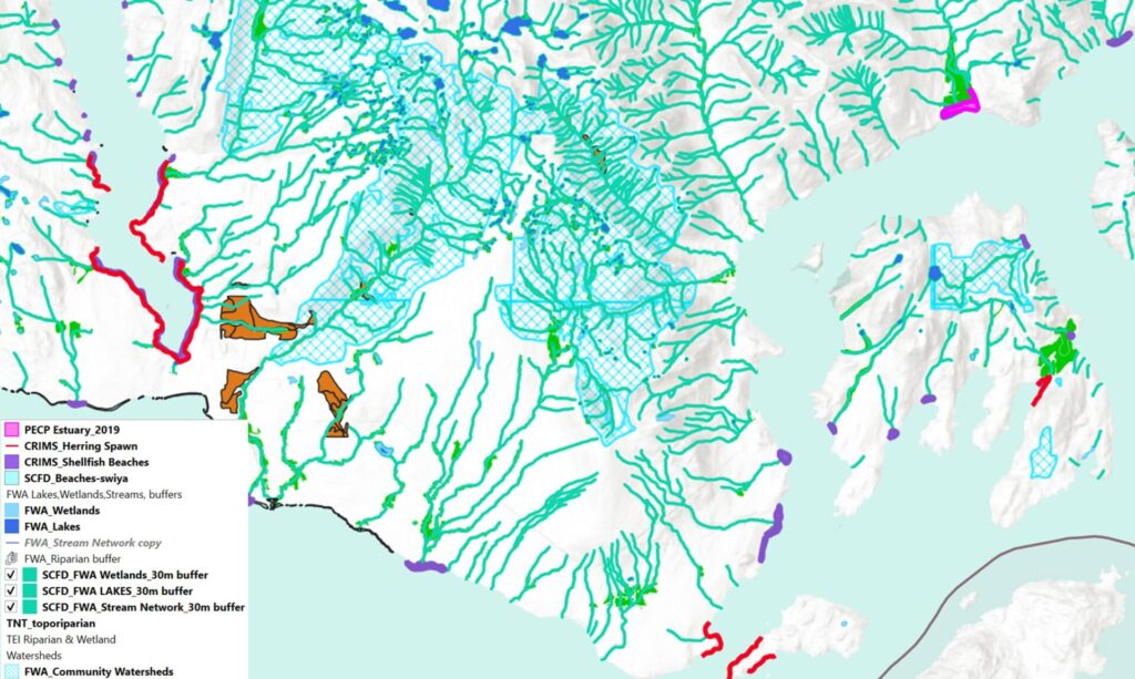
- Improve the health of watersheds and freshwater/marine shoreline habitat.
- Use an ecosystem-based approach to watershed planning and management to preserve ecological health and the ongoing function of ecological processes.
- Re-think engineering and design to include green infrastructure alternatives to grey infrastructure in riparian areas (e.g., bridges, culverts).
Regional Growth Strategy
Watershed based planning
Undertake watershed-based planning, integrated with the protection of ESAs, including wildlife corridors.
Official Community Plan
Protect wetlands
Conserve wetlands to sustain their water storage, ecological, carbon and socioeconomic functions.
EDPA with 30m setback from streams
Establish a requirement within the EDPA guidelines for a 30-metre setback from the stream boundary when conducting development on properties subject to the Riparian Areas Protection Regulations (RAPR), whenever opportunities for a 30-metre setback are possible.
Professional advice when RAPR is not met
Conduct analyses to predetermine setbacks on streams subject to the RAPR for areas where a 30-metre setback cannot be achieved.
Impact Assessment
Ensure that development does not negatively impact watercourse or wetland environments or, where such impacts are unavoidable due to the existing configuration of parcels of land in relation to watercourses or wetlands, to ensure that development does not result in a net loss of productive fish habitat.
Favour green over gray infrastructure
Favour nature-based solutions & green infrastructure options (e.g., rain gardens, vegetated swales) when planning for grey infrastructure replacement, such as dams and other water management features.
Maintain quality and function
No loss of quantity, quality, and function of wetlands. Monitor water quality and prevent pollution.
Map a wetlands and wet forest
Identify, map, and classify all the wetlands and wet forest
Marine
Conserve and restore natural shorelines
Develop a shoreline policy to conserve remaining natural shorelines, and restore armored shorelines with green shores approaches to the maximum extent possible .
Indicators and Targets
Water quality
- 100% of water samples at selected monitoring sites within the city meet BC Water Quality Guidelines. (City of Nanaimo, pg 20).
Length of naturalised stream
- Length of stream with canopy cover or naturalized embankments.
- Length of stream that is compliant with provincial legislation setbacks
Naturalised marine shoreline
- Increase the length / area of naturalised shoreline (District of Sechelt S3.0) – Pacific Salmon Foundation Shore line mapping project.
Biodiversity Strategy
Policy language | Adapted from | Indicator / target |
Ensure the Zoning Bylaw is consistent with the Streamside Development Permit Area (SDPA) to better protect streams and the marine shoreline. | District of Saanich Biodiversity Conservation Strategy, 3.13.3 pg 53 | |
Clarify all watercourses are included in the SDPA that meet the definition, including unmapped watercourses. | District of Saanich Biodiversity Conservation Strategy, 3.13.2 pg 53 | |
Increase the minimum riparian setback enforced in the Zoning Bylaw to 10 m for watercourses and 2 m for ditches to better align with minimum RAPR SPEA sizes. Apply to both fish-bearing and non-fish-bearing streams. | District of Saanich Biodiversity Conservation Strategy, 3.13.4 pg 53 | |
Establish a Riparian Development Permit Area (DPA) for all Class A, A(0) and B watercourses outside of the ALR to protect biodiversity, water quality and slope stability. | City of Surrey’s Biodiversity Conservation Strategy A-2.2 pg 84 | Width of Development Permit Area (DPA) will include the watercourse, riparian area and extend to 50 m from the top of bank. |
Enforce minimum Streamside Protection and Enhancement Areas setbacks from top of bank for Class A, A(O) and B watercourses; disturbed areas within SPEAs must be restored as a condition of development. | City of Surrey’s Biodiversity Conservation Strategy A-2.3 pg 84 | |
All properties, including all or a portion of the Riparian DPA, are subject to the DPA guidelines. Any development within the Riparian DPA requires a QEP to assess and prescribe management that will meet the objectives of the Biodiversity Conservation Strategy. | City of Surrey’s Biodiversity Conservation Strategy A-2.2 pg 84 | |
Accurately map the locations of connected and disconnected wetland systems and use this information in planning and development permit application reviews. Make this information available via the GIS portal. | District of Saanich Biodiversity Conservation Strategy, 1.10 pg 47 | |
Update the mapping of marine-influenced ecosystems and make this available via the GIS portal. | District of Saanich Biodiversity Conservation Strategy, 1.11 pg 47 |
Ecosystem Connectivity – Objectives
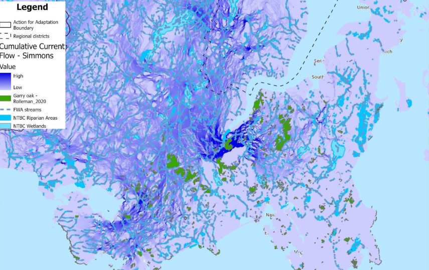
- Identify connectivity as a principle in plans and bylaws and identify connectivity on maps.
- Define zoning and support policy with bylaws that enable and protect ecological connectivity
Regional Growth Strategy
Define green corridors / Ecosystem Connectivity
Ensure OCPs adopt clear definitions and guidelines for ecological greenways and work with neighbouring local governments to create region-wide linkages.
Collaborate to deliver ecosystem connectivity
Work with member local governments to establish or strengthen policies within OCPs that ensure the long-term protection of ecological connectivity hubs and corridors depicted on [maps], including policies aimed at connecting these lands and buffering them from activities in adjacent urban areas.
Official Community Plan
Collaborate to produce cross jurisdictional corridors
Cross-jurisdictional ecosystem connectivity corridors will be established to preserve and restore long-term connectivity between sensitive ecosystems.
Link high biodiversity ecosystems
ESAs, riparian areas, and natural areas will be linked, using green corridors where appropriate, and designed to maintain biodiversity; or
Ensure connectivity of properties and landscapes to support ecosystem processes. This includes incorporating considerations such as wildlife movement and historical hydrological patterns into the development proposal including transportation and utility corridors.
Use EDPAs and covenants to protect connectivity
Ecosystem connectivity will be protected through EDPAs and conservation covenants, and by coordination and collaboration among jurisdictions.
Install under and over passes
Where appropriate, install wildlife over- or under-passes to maintain connectivity corridors and reduce wildlife-vehicle collisions.
Develop a Ecosystem Connectivity Strategy
Evaluate and bring together existing policies, plans, and programs, and conduct additional research as necessary, to inform a Biodiversity and Green Infrastructure Network Strategy.
Indicators and Targets
Securement of connectivity corridors
- Percentage of green infrastructure network in public ownership (City of Surrey, pg 304)
Biodiversity Strategy
Policy language | Adapted from | Indicator / target |
Implement measures to improve wildlife crossings within the green infrastructure network to facilitate movement and reduce traffic mortality. | City of Surrey’s Biodiversity Conservation Strategy A-2.7pg 84 |
|
Protect land in the Biodiversity Habitat Network through working with private landowners using a variety of existing tools such as covenants, and through land acquisition.
| District of Saanich Biodiversity Conservation Strategy, pg 49 |
|
Protect land in the Biodiversity Habitat Network through priority invasive species removal and ecosystem restoration on public land. | District of Saanich Biodiversity Conservation Strategy, 2.1.3 pg 49 |
|
Identify missing components adjacent to the Biodiversity Habitat Network that could be restored to improve the network. | District of Saanich Biodiversity Conservation Strategy, 2.3 pg 50 | |
Add the Biodiversity Habitat Network to the Park Acquisition Plan and identify priority lands for acquisition. | District of Saanich Biodiversity Conservation Strategy, 2.4 pg 50 | |
Assess unused rights-of-way within the Urban Containment Boundary for restoration potential and/or potential to rezone to natural area parks. | District of Saanich Biodiversity Conservation Strategy, 2.6 & 2.7 pg 50 Vancouver Board of Parks & Rec Biodiversity Strategy 1-1, pg. 31 |
|
Regional Growth Strategy
Identify and protect natural areas
Work with the federal and provincial governments to identify and protect natural areas that are representative of the region’s ecosystem and form systems of interconnected areas and natural corridors capable of sustaining native plant and animal communities.
Increase awareness in the community of ecosystem services
Work with property owners, businesses, the provincial government, and First Nation communities to improve, support, and increase awareness of the essential services that forests provide in the region such as:
- ecological diversity and a healthy natural environment
- natural stormwater management, erosion reduction, water filtration
- carbon dioxide storage
- air temperature moderation in urban areas
- spiritual and cultural enrichment
Develop online mapping tools
Use a sensitive ecosystems atlas as a common method of collecting and displaying conservation and environmental information.
Update mapping of ESA
Encourage local governments to either individually or jointly regularly update environmental mapping that depicts critical information such as sensitive ecosystems, watercourses and riparian areas, parks and greenways.
Bio-inventory of ESAs
Prepare a complete bio-inventory of regionally significant ESAs, SAR, and the natural biodiversity of the region.
Official Community Plan
An ecosystem-based approach to planning and management will be used to preserve ecological health and the ongoing function of ecological processes.
Protect ESAs in a natural conditions
Preserve sensitive ecosystem areas, their living resources, and connections between them in a natural condition and maintain these areas free of development and human activity to the maximum extent possible.
Produce an Urban Tree Strategy to protect canopy cover
Protect and expand the existing urban forest / tree canopy through implementation of an Urban Forest Strategy, ensuring that planted tree species are appropriate for forecast climate conditions and that large native trees are preserved.
Regional approach to protecting ESAs and connectivity
Collaborate with landowners, other levels of government, non-governmental organizations, and neighbouring jurisdictions in developing regionally consistent approaches to conserving, and restoring environmentally sensitive areas, watershed health and species at risk, using the principles of precaution, connectivity, and restoration.
Develop Management Plans for Parks
Develop management plans for all natural area parks that focus on protecting or enhancing ecological integrity of ecosystems, ESAs, and connectivity corridors.
Restore damaged ecosystems
Work in collaboration with property owners, developers, businesses, and appropriate provincial and federal agencies to restore damaged ecosystems and utilize mapping to identify highest priority areas.
Mapping
Regularly update ecosystems data
Regularly update ecosystem data (e.g., terrestrial, aquatic, marine, invasive species, and species at risk) as new information becomes available and make it available on a public GIS portal. Continue to refine the precision of terrestrial ecosystem polygon boundaries through ground-truthing and high-resolution ortho imagery.
Collaborate for regional approach to mapping
Collaborate with landowners, other levels of government, non-governmental organizations, and neighbouring jurisdictions to develop regionally consistent approaches to inventorying and mapping ESAs and species at risk.
Map a baseline of ecological condition
Map and inventory baseline ecological conditions before deciding what to change: to inform long-term planning, establish and fund a land cover and land cover change monitoring program that targets natural areas and features.
Indicators and Targets
Maintain urban canopy cover
- Target goal of 40% canopy coverage for the entire city (Surrey pg 149); or
- Achieve 40% tree canopy cover within the Urban Containment Boundary (Metro Vancouver pg 35); or
- Every neighbourhood has at least a 30% canopy coverage (City of Nanaimo pg 19)
Area of natural environment protected
- Protect 50% of the region for nature (Metro Vancouver pg 35)
- Area of CVRD protected as park (Cowichan Valley Regional District pg 15)
- Track the type of ESAs in each electoral area (Cowichan Valley Regional District pg 14)
Biodiversity Strategy
Policy language | Adapted from | Indicator / target |
Update and map the known locations of species and ecological communities at risk and provide this information to the BC Conservation Data Centre. | District of Saanich Biodiversity Conservation Strategy, 1.12 pg 48 |
|
Work with provincial government and stewardship groups to help restore ecologically important native species. | Vancouver Board of Parks & Rec Biodiversity Strategy 1-2, pg. 31 |
|
Identify opportunities to rezone lands containing, in whole or in part, critical habitat for species at risk to natural area parks. |
|
|
Ensure critical habitat for species at risk that occurs in natural areas is protected from inappropriate use and disturbance. | ||
Update and map the known locations of species and ecological communities at risk and provide this information to the BC Conservation Data Centre. | District of Saanich Biodiversity Conservation Strategy, 1.12 pg 48 | |
Work with provincial government and stewardship groups to help restore ecologically important native species. | Vancouver Board of Parks & Rec Biodiversity Strategy 1-2, pg. 31 |
|
Regional Growth Strategy
Nature based solutions to climate change and connectivity
Encourage land use, infrastructure, and human settlement patterns that reduce fossil fuel and the associated emissions, create carbon storage opportunities, and improve ecological connectivity.
Official Community Plan
Track land cover change
Use land cover monitoring to identify different ecosystem types (e.g., forest, riparian) and aim for no net loss of native vegetation post-development.
Establish retention targets for land cover types
Use land cover change monitoring to identify retention or connectivity targets, e.g., no net loss or net gain of certain land cover types (ESA, riparian, forest, etc.).
Indicators and Targets
Track changes in land cover
- Track area impacted by development and logging. (Cowichan Valley Regional District pg 13)
- Track type and proportion of natural areas (City of Surrey pg 93)
Biodiversity Strategy
Policy language | Adapted from | Indicator / target |
Develop a long-term land cover monitoring program to reflect the state of carbon and biodiversity in the community. | District of Saanich Biodiversity Conservation Strategy, 1.6 pg 46 | |
Develop incentives to increase density and encourage alternative development approaches (e.g. cluster housing, Conservation Subdivision Design) to retain natural areas and enhance buffer zones adjacent to green infrastructure, particularly inside the urban containment boundary. | City of Surrey’s Biodiversity Conservation Strategy A-2.6 pg 84 District of Saanich Biodiversity Conservation Strategy, 3.7, pg 52 | Density incentives are established and promoted. ## of hectares of natural area protected through alternative development approaches. |
Establish forest canopy baseline and cover targets for different land uses that will contribute towards the community goal of ##% canopy cover. | City of Surrey’s Biodiversity Conservation Strategy A-2.9 pg 85 | Canopy cover baseline and targets established. |
Develop / support a tree incentive program to increase tree cover on private land. | City of Surrey’s Biodiversity Conservation Strategy A-2.11 pg 85 | # of private land owners utilize the incentive program by [date] Tree canopy or number of trees on private land increased by X% by [date] |
Develop / update the Tree Bylaw to enhance protection and replacement criteria for all healthy single stemmed trees with a diameter greater than 100 cm measured at 1.4 m above ground. | City of Surrey’s Biodiversity Conservation Strategy A-2.12 pg 85 | Tree Bylaw created / updated with specific targets |
Develop or update ground-truthed terrestrial ecosystem mapping (TEM) that identify disturbance levels. | District of Saanich Biodiversity Conservation Strategy, 1.4 pg 46 | TEM updated/completed by [date] |
Review and update existing data capture guidelines and develop a structured procedure for evaluating and submitting data to be included as part of terrestrial ecosystem mapping. | District of Saanich Biodiversity Conservation Strategy, 1.2.2 pg 45 | TEM data guidelines updated by [date] and widely shared. |
Regional Growth Strategy
Jurisdiction
Regional Growth Strategies (RGS) are enabled under the Local Government Act (LGA) Part 13. An RGS is a voluntary, consensus-based regional land use planning policy document coordinated by a regional district for its member municipalities. An RGS should address regional environmental goals with a 20-year timeline. All regional district bylaws and plans, and all OCPs of member local governments must be consistent with the RGS.
A well-crafted RGS can drive the protection and development of ecological networks across jurisdictional and ownership boundaries by designating biodiversity corridors. Objectives and policies for ecosystem protection should be stated. This helps raise the profile of regional ecological values and explain links between sensitive ecosystems and biodiversity to programs such as waste management, water conservation and responses to climate change. An RGS should recommend that protection of these ecosystems be incorporated into municipal OCPs, green infrastructure planning, watershed planning, biodiversity conservation strategies, environmental management systems and corporate strategic and operational documents.
An RGS may also identify land acquisition priorities and may itself include a regional biodiversity conservation plan. Almost all RGSs in the province contain urban growth boundaries and policies to direct new development into serviced or near urban areas, with the aim of leaving rural and natural landscapes less disturbed. An RGS can also enhance the effectiveness of stewardship initiatives and facilitate collaborative financing.
RGS policy provisions
To support biodiversity and protect connectivity, an RGS should at a minimum contain policies that:
- clearly define “urban” and “rural” in terms of lot size and density;
- contain urban areas, and direct development and density into already serviced areas;
- protect rural landscapes from fragmentation;
- include maps designating land into classes or categories, including sensitive ecosystems, regional greenway or biodiversity corridors, unprotected green space, and priority parkland acquisitions;
- cluster development away from ESAs and SAR; and
- enable development of a regional biodiversity conservation strategy.[1]
- Incorporate nature-based solutions to protect communities from natural hazards such as drought, flood, storms and heat domes.
Examples of policy text drawn from existing RGS in the project area. In most cases, these are policies that member municipalities have adopted in their bylaws.
Policy statement | Adapted from | Indicators |
Conserve and enhance biodiversity and ecological services by protecting ecologically important features and corridors, including floodplains, shorelines, intertidal areas, stream systems, aquifers, and urban forests. | City of Nanaimo Shaping Our Future 2040 (2024), policy 2.8, pg 29 | Area of natural forest, floodplain, riparian buffers, intertidal areas, aquifers – tracked over time. |
Encourage local governments to work together and with First Nations and other organizations to adopt consistent actions and policies for environmental and natural asset protection, through OCPs, zoning (protection or EDPAs), restoration, ecological connectivity, watershed health and other mechanisms, that promote the principles of precaution, connectivity and restoration. | Comox Valley RD RGS obj 2-B1, pg 37 | |
Consider the impacts on ecological structure and function of land use decisions and require an environmental review for projects with the potential to negatively affect ESAs, the coastal zone, or environmental quality. | City of Nanaimo Shaping Our Future 2040 (2024), policy 2.13, pg 29 |
[1] Garry Oak Ecosystems Recovery Team. 2014. Model Bylaws for the Protection of Garry Oak and Associated Ecosystems. Victoria, B.C. 187 pp. Available at https://goert.ca/wp/wp-content/uploads/GOERT-Model-Bylaws-2014.pdf
Official Community Plan (OCP)
Official Community Plans (OCPs) are enabled under the Local Government Act sections 471-475, and 477-478 and are adopted as a local government bylaw. An OCP is a statement of goals, objectives, and policies intended to guide local government decisions on planning and land use management within the area covered by the plan.
LGA s.473 (1)(d) states that an OCP must include statements and map designations for the area covered by the plan with respect to restrictions on the use of land that is subject to hazardous conditions or that is environmentally sensitive to development. LGA s.488(1)(a) states that an OCP may designate development permit areas for protection of the natural environment, its ecosystems and biological diversity. With this authority, local governments may, for example, set EDPA guidelines for protecting ecosystems.
Theme | Policy statement | Adapted from | Target / Indicator |
Leadership / Multi-theme | Integrate public trees, forests, and green infrastructure into asset management planning, including budgeting, policy development, and staff resourcing. | City of Courtenay OCP NE23 pg 127 | |
When conducting comprehensive OCP reviews, ensure that the most currently available information regarding canopy cover, sensitive ecosystem inventories, connectivity analysis and invasive species inventories are included to inform long range land use decisions and Development Permit guidelines. | City of CourtenayUrban Forest Strategy 2019 – 2050 pg 83. | ||
First Nations | Commit to incorporating Indigenous perspectives into land use decision processes. Seek guidance from Indigenous partners in how to make this commitment a reality. | City of Courtenay OCP pg 20 | |
Work with local First Nations to consider protections for culturally important featuresand identify current habitat linkages and how to re-establish missing linkages. | |||
Work with local First Nations to develop effective conservation strategies. | |||
Explore Indigenous Protected and Conserved Areas, Land Codes, and other land stewardship approaches as opportunities to collaborate with First Nations. | |||
Work with First Nations to consider culturally important features and identify current habitat linkages and how to re-establish missing linkages. | |||
General | Protect natural areas by maintaining the Urban Containment Boundary (UCB) and encouraging compact urban development inside the UCB. | Saanich OCP 6.1.3 pg. 40. | Percentage of residential growth occurring within the Urban Containment Boundary (Metro Vancouver, Regional Planning pg. 390). |
Environmental Development Permit (EDPA) | |||
Protect areas of high environmental sensitivity by not permitting development on these sites, or through development control and the securing of these areas in public ownership where appropriate. | Port Coquitlam OCP s. 7.4, pg. 37. | ||
Any property within 50 m of a stream or that contains an ESA may require an EDP. No site clearing, regrading or other land disturbance is permitted until an EDP is issued. Several different types of reports and plans may be required as part of the EDP application. Information on each of these reports/plans can be found at [insert links as appropriate]. | City of Abbotsford Natural Environment Development Permit policy | ||
Require developments adjacent to ESAs, including ecosystem connectivity opportunity areas, be subject to EDPA guidelines | City of Courtenay OCP NE28 pg 128 | ||
Utilize Streamside Development Permit Areas for ecosystem corridor connection opportunities. | |||
Prior to any development work on lands that contain an EDPA, including site preparation, an EIA shall be prepared by a QEP and have input from other professionals of specific expertise where required. | |||
Dedicating very small parcels as park to satisfy DPA requirements will be avoided unless contiguous with or within 50 m of existing natural area parks and unless they will be maintained free from invasive species. | |||
Develop detailed terms of reference with standards to direct consistent performance by QEPs to safeguard sensitive ecosystems from adverse effects. | |||
EDPA – Environmental Impact Assessment | |||
Require all development proposals on properties equal to or greater than 4,000 metres square in size to submit an Environmental Impact Assessment (EIA) to determine the presence or absence of Environmentally Sensitive Areas | City of Courtenay OCP NE27 pg. 127. | ||
Site assessments or EIAs will be assessed by staff having appropriate ecological expertise(e.g., environmental planner). | |||
Where it is determined that an EIA is required, establish clear terms of reference to direct how the EIA is to be carried out. | |||
Consider requiring an EIA for all properties showing an ESA or any property >1 ha, even if previously disturbed. | |||
All development proposals that involve a change in zoning, subdivision, or amendment to a plan must undergo an environmental impact assessment process before development approvals are granted. Development design must reflect the objectives and guidelines of best management practices. | |||
Site assessments shall require consideration of cumulative effects, such as habitat fragmentation, as well as off-site impacts, such as increased risk of flooding or sedimentation downstream. | ACT, s. 2.1.1 pg. 9. | ||
Bylaws | |||
Adopt or update a Tree Protection Bylaw to strengthen tree cover protection. | District of Sechelt Tree Protection Bylaw Township of Esquimalt Tree Protection Bylaw | Target goal of 40% canopy coverage for the entire city (Surrey pg 149) or Achieve 40% tree canopy cover within the Urban Containment Boundary (Metro Vancouver pg 35) or Every neighbourhood has at least a 30% canopy coverage (City of Nanaimo pg 19) | |
Enact Zoning Bylaw requirements to avoid impact to ESAs, including but not limited to: a. Cluster housing zones to allow for a tighter grouping of homes on the most buildable portions of the property in exchange for retaining larger portions of the land in a natural state, and allowing the owner(s) of land containing ESAs to use the original site area in computing density allowances, in accordance with the Zoning Bylaw; b. Density bonusing in exchange for increased nature protection or restoration; and c. Limiting the extent of impervious surfaces. | City of Courtenay OCP NE25 pg 127 | ||
Monitoring, compliance and enforcement | |||
Monitor compliance and other legal requirements such as covenants related to protecting sensitive ecosystems. | City of Courtenay OCP NE7 pg. 124. | Produce a State of the Environment report every five years. | |
Commit resources for effectiveness monitoring of replacement lands or restoration of lands. | |||
Indicators and Targets
Percentage of residential growth occurring within the Urban Containment Boundary (Metro Vancouver, Regional Planning pg. 390).
Target goal of 40% canopy coverage for the entire city (Surrey pg 149), or
Achieve 40% tree canopy cover within the Urban Containment Boundary (Metro Vancouver pg 35), or Every neighbourhood has at least a 30% canopy coverage (City of Nanaimo pg 19)
Produce a State of the Environment report every five years.
Biodiversity Strategy
With current climate change projections, warmer and drier summers are expected to reduce moisture available to trees during the growing season. Windstorms, pests and diseases, drought and wildfire already affect the region’s natural and urban forest, and in the future, the variability, frequency and intensity of disturbance events will increase. By planning for these conditions in biodiversity, urban forest, and climate strategies, local governments will be better positioned for climate resilience and healthier communities.
Strategy statement | Adapted from | Indicator / target |
Base decisions on sound science while incorporating local knowledge and expertise. |
| |
Manage biodiversity at a city-wide scale and engage neighbouring jurisdictions to build on existing networks of natural areas and biodiversity hotspots.
|
| |
Develop an inventory of natural assets and develop a Natural Asset Management Plan (see section4.10.2). | District of Saanich Biodiversity Conservation Strategy, 3.1, pg 51 | Inventory completed by [date] |
Make restoring ecological function a priority over rigid interpretations of naturalness. Favour planting native species but consider appropriate non-native species to enhance biodiversity in urban areas. | Biodiversity consists of >75% native species | |
Encourage “urban ecosystems” such as green roofs, rain gardens, and wildlflower meadows that have a mix of native and non-native species to enhance urban biodiversity and provide people with access to nature. |
| |
Incorporate climate projections such as increased summer drought, rising sea level, and more intense rainfall and storm events into all biodiversity projects such as tree planting and wetland restoration. |
| |
Improve development review and permitting processes, including the tree protection bylaw and other green policies to better protect and enhance biodiversity during development. | City of Vancouver Biodiversity Strategy,action 21, pg 37 | Policies are vetted by a QEP or similarly experienced staff. Policies are integrated across all departments. |
Consider incentives to restore degraded habitat during re-development. | City of Surrey’s Biodiversity Conservation Strategy A-2.8 pg 84 | Incentives are established and promoted. ## of hectares of habitat restored in [timeframe] |
Allocate resources to identify and deal with encroachments into [jurisdiction] owned natural lands, including naturalized right of ways and mandate their restoration. | District of Saanich Biodiversity Conservation Strategy, 3.2, pg 51 | Resources are allocated. ## of hectares of natural lands by [timeframe] |
Implement an environmental development permit area or for the protection of the natural environment and ensure guidelines are clear and well-communicated. | District of Saanich Biodiversity Conservation Strategy, 3.12, pg 53 |
|
Monitor and measure performance and adapt actions accordingly. This requires establishing appropriate indicators and measuring against targets. Draw on ecological expertise to identify appropriate indicators and targets. | The status of biodiversity and the success of biodiversity programs and projects are measured using monitoring and other methods. | |
Adopt and implement an Urban Forest Strategy. | District of Saanich Biodiversity Conservation Strategy, 3.8 pg 52 | Urban Forest Strategy in implementation within 2 years of adoption. |
Build partnerships with First Nations to collaborate on biodiversity management. | City of Vancouver Biodiversity Strategy,action 25, pg 39 | Collaborative biodiversity tables with local First Nations established and functioning. |
Support local Indigenous peoples in spatial knowledge acquisition and organization on their terms. | District of Saanich Biodiversity Conservation Strategy, 1.7 pg 46 |
|
Resources
Green Bylaws Toolkit for Protecting and Enhancing the Natural Environment and Green Infrastructure
The Green Bylaws Toolkit shares information in relation to the planning tools available to local governments for the protection and stewardship of the natural environment. The toolkit provides applied examples for each of the tools and discusses the opportunities and challenges with applying them. Section 3 of the toolkit provides sample bylaw provisions with examples of language that planners could use.
Available at https://stewardshipcentrebc.ca/green-bylaws/
Develop with Care: Environmental Guidelines for Urban and Rural Development in British Columbia
The Develop with Care is a series of guidelines that the province produced in 2014 to maintain
environmental values during the development of urban and rural lands. The guidelines include the following sections:
- Community Planning
- Site Development and Management
- Environmentally Valuable Resources
- Regional Information
These guidelines can be accessed here.
Natural Solutions Initiative: Regulatory Mechanisms Toolkit. Action on Climate Team, Simon Fraser University
Municipalities are seeking ways to incorporate the protection of nature-based solutions to climate change into their planning and decision making. However, planners have indicated that they struggle to identify appropriate regulatory mechanisms for achieving that goal. This toolkit has been designed to support that process and to be applied at two scales – watershed and community.
This toolkit can be accessed here.
Model Bylaws for the Protection of Garry Oak and Associated Ecosystems
The purpose of the Model Bylaws for the Protection of Garry Oak is to support local governments and First Nations in the development of regulations to protect Garry oak and its associated ecosystems which are some of the most imperiled ecosystems on Earth.
Governments often have to find a balance between environmental protection with economic, cultural and social outcomes, but south west BC has some of the rarest ecosystems due to colonization, urban development, agriculture and forestry.
To access this guidance document click here.
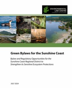
Green Bylaws for the Sunshine Coast: Bylaw and Regulatory Opportunities for the Sunshine Coast Regional District to Strengthen its Sensitive Ecosystem Protections
The purpose of this report was to review the Sunshine Coast Regional Districts existing approach to the protection of ecosystems and to make recommendations as to how these could be strengthened. The recommendations put forward include:
- Support ecosystem connectivity
- Establish long-term, district-wide objectives and policies
- Establish binding mechanisms to guide development away from sensitive ecosystems
- Enhance the power and efficiency of environmental impact assessment procedures
- Ensure that planning and development decisions are based on a comprehensive and
scientific base of knowledge
To access this report click here.